
Woke at 6 and was ready by 6:10. Phoned a cab and after a bit of trouble making myself understood, (which I found out later I had not) I made a little lunch breakfast to take on the bus. I left by 6:40 and waited outside, but there was no cab. At 6:45 no cab. I was starting to worry as we were supposed to be at the place by 7 and although it wasn't that far, it was too far to walk and get there on time.
Margie and Maureen were out by 650 but still no cab. A cab driver who was just finished for the night and happened to live on our street was surprised that our cab had not shown up but pointed us in the right direction to find a cab. With great relief we caught a cab in Paris! The traffic was basically not there at that hour and so made it to the place in plenty of time.
It is definitely interesting try to make yourself understood in a foreign language. Thank God for Dennie. She was not afraid to try her French. Every time I wanted to ask something I totally seemed to forget all my high school french!
On to the bus and at 7:15 we were off. The weather was nice, and we passed the ET with the sun just starting to kiss the top. It certainly looked different than the night before, for one thing we could see it.
The traffic got very slow going out of Paris and did not pick up any speed until we passed a traffic accident. the price of gas is 1.68E a liter!
I loved the signs. Hre we have pictures of deer There they had pictures of wild boars!
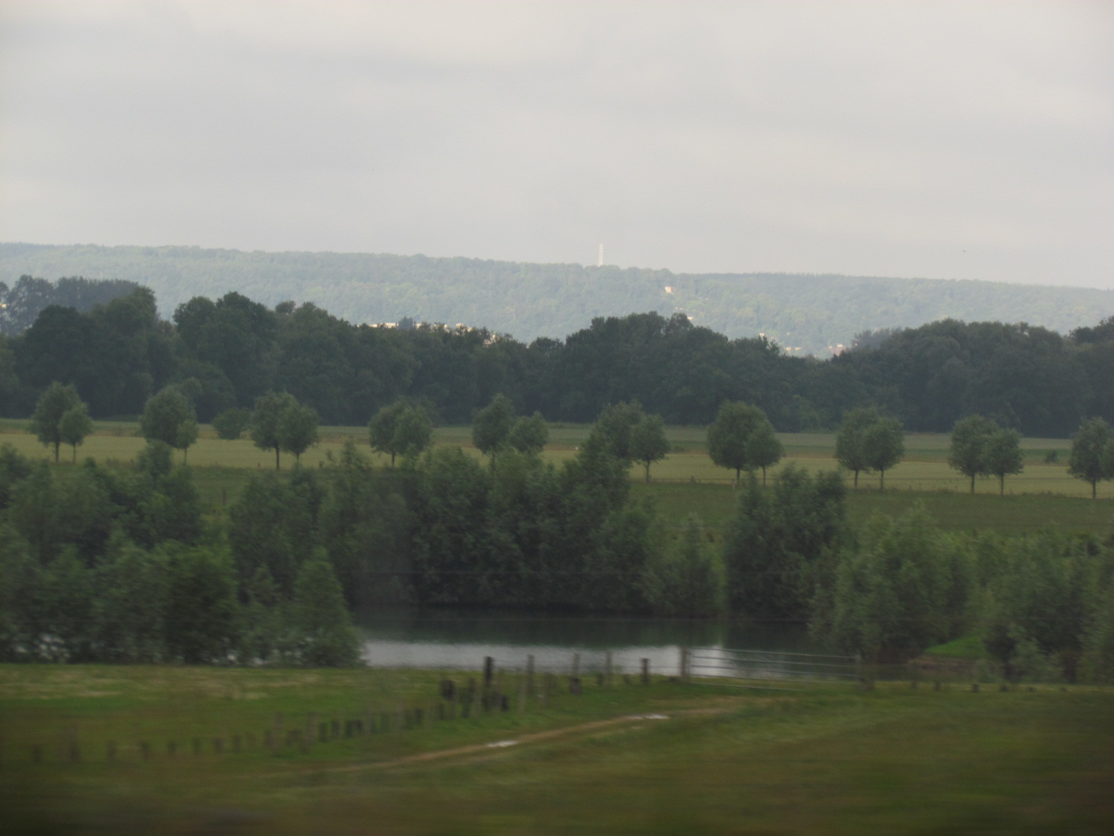
It was getting cloudier as the trip progressed. By Rowen it was 8:25 am. Maureen had settled in and was asleep again but Margie and I were wide awake with our cameras "At the ready". A toll booth at Louviers at 843; sunshine at 844; farms, fields, cows, rivers and streams.
At 910 we stopped for 30 minutes at a truck stop. There were clean washrooms. I had an apple turnover. we found out that we were only half way to Mont St Michelle. the brochure had said a few hours out of Paris. I always thought a few was three or less. at 9:40 on the road again into sunnier Normandy. Pretty, pretty country.
The tour guide was a Young girl Aurora who gave talks about Mont St Michelle on our way there. Sometimes with each person and sometimes on the audio system.
Mont-Saint-Michel has been the subject of traditional, but nowadays good-humoured, rivalry between Normans and Bretons.
(kind of like Edmonton and Calgary) Bretons claim that since the Couesnon River marks the traditional boundary between Normandy and Brittany, it is only because the river has altered its course over the centuries that the mount is on the Norman side of the border. This legend amuses the area's inhabitants, who state that the border is not located on the Couesnon river itself but on the mainland at 4 kilometres (2.5 mi) in the west, at the foot of the solid mass of Saint-Brelade.
We passed poppy fields and all along the road side was broom, foxglove, daisies and goldenrod. By 1130 we were into rolling hills with cows in fields divided by trees. More toll booths. The highway is a nice highway, divided and with multiple lanes. The bus was comfortable enough although there was no washroom.
Aurora continued:
Religious Hermits lived on the island since the 4th century.
the island was called "monte tombe",
before the construction of the first monastic establishment in the 8th century. According to legend, the Archangel Michael appeared to St Aubert, bishop of Avranches, in 708 in a dream and instructed him to build a church on the rocky islet. Aubert repeatedly ignored the angel's instruction, until Michael burned a hole in the bishop's skull with his finger.
We passed more rivers and country houses, farms and gardens , small villages and turnoffs to larger centers. At 12 noonish we rolled through a small very spread out town with narrow roads on a very flat area of a large bay and then we saw Mont st michelle. (I'm a little fuzzy about how 5 hours could be misconstrued and described as a few hours drive in the descriptor on the web site?).
They don't want to scare people off!
Mont St Michelle is very impressive even from a distance. By the time we got to the parking lot, parked, walked the quarter mile (where we passed a washroom and so used that as there was no washroom on the bus! and got in heck for doing that) to the transfer bus which took us across the dyke road to our drop off pik up point, and then continued on walking another quarter mile to the entrance gate it was 1245.
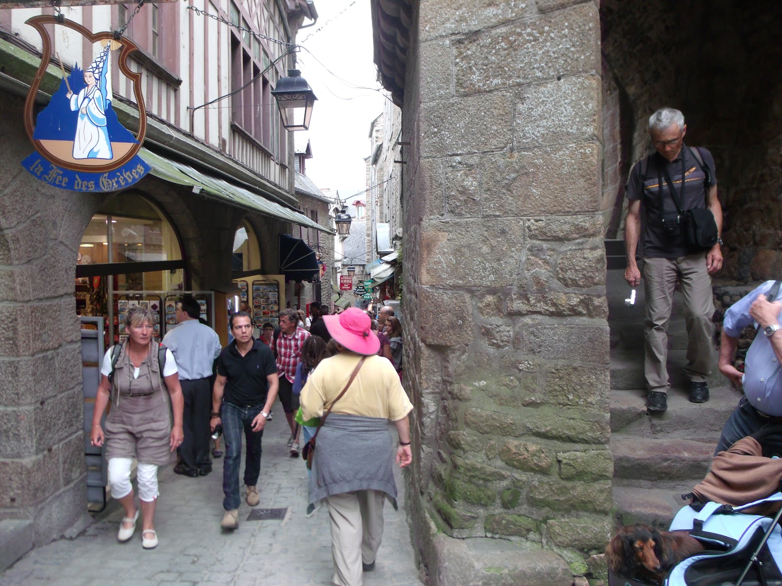
After some very clear instructions on what time to be back at the main gate to go home, we followed Aurora up a very steep narrow lane-way lined with small shops and crowded with people. I made this sound easier that it was. The narrow lane was crowded with tall people.
Aurora is short and so to enable us to see her she held a pop bottle over her head but we still could not see her very well as she walked very fast snd so was always ahead of us and having to wait, not just for us either, but most of the people in the tour.
She was very hard to keep up with! and as Dennie said hard to see over all the people in front of us.
We made it to our restaurant and enjoyed a very good meal that we had pre-booked. If we had known that we were only going to have two and a half hours to see everything, we would not have done this, we would have just grabbed a sandwich on the go from one of the numerous small shops on the island.
It was a very unique omelet-all frothy and extremely delicious-but also quite expensive. But live and learn, I guess.
Needless to say, our lunch of omelets was very good in a very cool restaurant that must have been 500 years old by the feel of the tilt to the floor and the way the windows opened. we had a great view of the tidal flats and
we chatted about that. I tried to take some photos of some poppy fields across the bay but they were just fuzzy red lines in the photos.
The tides in the area change quickly, and have been described by Victor Hugo as "
à la vitesse d'un cheval au galop" or "as swiftly as a galloping horse".
The tides can vary greatly, at roughly 14 metres (46 ft) between high and low water marks. Popularly nicknamed "St. Michael in peril of the sea" by medieval pilgrims making their way across the flats, the mount can still pose dangers for visitors who avoid the causeway and attempt the hazardous walk across the sands from the neighbouring coast.
 We discussed the reasoning behind the school groups out on the sands while we were eating lunch. Possibly secretly hoping to see the tide come in like a galloping horse and chase the running children and teachers up the beach.

After our excellent large lunch of foamed omelets we waddled up the narrow lane-way. We were surprised that we were only about halfway to the abbey. Maureen stopped to browse through some shops and so Margie and I went on. At the top of the laneway is a very long staircase.
Needless to say we stopped a few times to "take pictures". After the long open staircase was another covered staircase. Oh goody! And my calves were still sore from trying to climb the Eiffel tower the night before! But we made it with a few pit stops.
Maureen caught up at the entrance to the abbey but had misplaced her ticket, which Aurora had told us not to lose when she gave them to us, so Maureen had to buy another ticket. The whole Mont St Michelle is so Cool!
after the entrance check in hallway we went up another staircase! to the outside again.

Around a long narrow path of high walls and more stairs built right into/onto the rock of the island. At the top of this staircase is a large plaza courtyard with a magnificent view of the bay and surrounding countryside on two sides and the church on another.
Wikipedia says that
Mont Saint Michelle (Saint Michael's Mount) is a rocky tidal island in Normandy, France. It is located approximately one kilometre (just over half a mile) off the country's north-western coast, at the mouth of the Couesnon River near Avranches. The population of the island is 44, as of 2009.
The church is very large and beautiful with pale windows. I found out that once they had very bright colours but time had faded them to pale pale greens and pinks.
The island has held strategic fortifications since ancient times, and since the 8th century AD been the seat of the monastery from which it draws its name. The Mont-Saint-Michel and its bay are part of the UNESCO list of World Heritage Sites.
More than 3,000,000 people visit it each year. (A lot of them on the same day as we were there)
Mont Saint-Michel was previously connected to the mainland via a tidal causeway, i.e. a trackway covered at High tide and revealed at low tide. This connection has been altered over the centuries. The coastal flats have been diked off and drained to create pasture, thus the distance between the shore and the south coast of Mont-Saint-Michel has decreased, and the river has been canalised, reducing the flow of water and thereby encouraging a silting-up of the bay. In 1879, the tidal causeway was converted into a raised or dry causeway. This prevented the tide from scouring the silt around the mount.

In 2006, the French prime minister and regional authorities announced a €164 million project (Projet Mont-Saint-Michel) to build a hydraulic dam using the waters of the river and of tides to help remove the accumulated silt deposited by the rising tides, and to make Mont-Saint-Michel an island again. It was projected to be completed by 2015.
 The construction of the dam began in 2009 and is now complete. The project also included the removal of the causeway and its visitors car-park.( we saw lots of equipment working on that part of the project) It will be replaced by a light bridge, allowing the waters to flow freely around the island, which will improve the efficiency of the now operational dam, and a replacement car-park on the mainland. (that is were we parked) Visitors will use small shuttles (Yup we did that too but still on the causeway not the new bridge) to cross the future bridge which will still be open to pedestrians and unmotorised vehicles.
After the Church we followed other people through doors and into and through chambers and halls. At some point Maureen got separated from us. We found ourselves in the large Cloister which was stunning. with a lovely garden in the center.
Mont-Saint-Michel was used in the 6th and 7th centuries as an Amoricans stronghold of Gallo-Roman culture and power, until it was ransacked by the Franks, (Hence the French and France) thus ending the trans-channel culture that had stood since the departure of the Romans in AD 460.
The mount gained strategic significance in 933 when William "Long Sword", William 1 Duke of Normandy, annexed the Cotentin Peninsula, definitively placing the mount in Normandy. It is depicted in the Bayeux Tapestry (I have to Find out where that is so I can see it) which commemorates the 1066 Norman Conquest of England. Harold Earl of Wessex is pictured on the tapestry rescuing two Norman knights from the quicksand in the tidal flats during a battle with Conan II, Duke of Brittany. Norman Ducal patronage financed the spectacular Norman architecture of the abbey in subsequent centuries.
1067, the monastery of Mont-Saint-Michel gave its support to duke William of Normandy in his claim to the throne of England. It was rewarded with properties and grounds on the English side of the Channel, including a small island off the southwestern coast of Cornwall which was modeled after the Mount and became a Norman priory named St Michael's Mount of Penzance.
After the cloister came more passageways, halls both large and small and kitchens and rooms. It was a maze really. During the Hundred Years War, the English made repeated assaults on the island, but were unable to seize it due to the abbey's improved fortifications. Les Michelettes – two wrought-iron Bombards left by the English in their failed 1423–24 siege of Mont-Saint-Michel – are still displayed near the outer defense wall.
We passed a fresco of St Michael poking the abbot in the forehead. Quite funny really except here was this magnificent abbey on the Island and 1200 years old and very popular still, so obviously St Michael was on to something.
When Louis XI of France founded the Order of Saint Michael in 1469, he intended that the abbey church of Mont Saint-Michel be the chapel for the Order, but because of its great distance from Paris, his intention could never be realized.
The wealth and influence of the abbey extended to many daughter foundations, including St Michaels Mount in Cornwall. However, its popularity and prestige as a centre of pilgrimage waned with the Reformation, and by the time of the French Revolution there were scarcely any monks in residence.
The abbey was closed and converted into a prison, initially to hold clerical opponents of the republican régime. High-profile political prisoners followed, but by 1836, influential figures – including Victor Hugo – had launched a campaign to restore what was seen as a national architectural treasure. The prison was finally closed in 1863, and the mount was declared a historic monument in 1874. The Mont-Saint-Michel and its bay were added to the UNESCO list of World Heritage Sites in 1979, and it was listed with criteria such as cultural, historical, and architectural significance, as well as human-created and natural beauty.
The Italian architect William de Volpiano, who had built the Abbey of Fecamp in Normandy, was chosen as building contractor by Richard II of Normandy in the 11th century. He designed the Romanesque church of the abbey, daringly placing the transept crossing at the top of the mount. Many underground crypts and chapels had to be built to compensate for this weight; these formed the basis for the supportive upward structure that can be seen today. Today Mont-Saint-Michel is seen as a Romanesque style church.
Robert de Thorigny, a great supporter of Henry II of England (who was also Duke of Normandy), reinforced the structure of the buildings and built the main façade of the church in the 12th century. In 1204 the Breton Guy de Thouars, allied to the King of France, undertook the siege of the Mount.
Did I mention it was like a maze, a rabbit warren. We went outside and then inside, up stairs , downstairs, past windows looking in and windows looking out. It really was. We didn't see Maureen until the end and she didn't see half of the same things that we did. I really did love Mont St Michel though and was so glad that Maureen had suggested it.
After having set fire to the village and having massacred the population, he was obliged to beat a retreat under the powerful walls of the abbey. Unfortunately, the fire which he himself lit extended to the buildings, and the roofs fell prey to the flames. Horrified by the cruelty and the exactions of his Breton ally, Philip Augustus offered Abbot Jourdain a grant for the construction of a new Gothic-style architectural set which included the addition of the refectory and cloister.
Charles the VI is credited with adding major fortifications to the abbey-mount, building towers, successive courtyards and strengthening the ramparts.
There were some very cool halls with hanging gothic letters or symbols. there was the large wooden wheel used to bring stores up to the abbey. there were gardens and narrow passages and low ceilings and steep round staircases.
The structural composition of the town examplifies the feudal society that constructed it. On top God, the church and monastery, below this the Great Halls, then stores and housing, and at the bottom, outside the walls fishermen and farmers housing. all in a spiral lane-way on a hill. Very cool place.
Margie and I shopped our way down to the bottom of the road/lane in about 30 minutes. I bought some towels and lace and postcards. I found a post office too and picked up some stamps. We made it down to the gate about 330, ten minutes early for our appointed meeting time, so used the washrooms which we had to pay .40E to use but were actually clean. Maureen was not there. Maureen was late. I bought postcards/tea towels-touristy things-many little gifts to bring to the people back home.
 We waited for a bit and then we went to the bus stop as we walk slower than some of the group. Aurora was beside herself trying to get everyone rounded up. Maureen showed up about twenty minutes later saying that she was there at the gate, but we never saw her. Oh well, we were on our way back to Paris. We asked her where she got to and she asked us where we got to. We followed the other people and never went back through any door that we had been thorough already. She went back out into the courtyard of the church and lost us.
 We saw the effects of the polderisation and occasional flooding that created salt marsh meadows that were filled with grazing sheep. The well-flavoured meat that results from the diet of the sheep in the pré salé (salt meadow) makes agneau do pre-sale (salt meadow lamb), a local specialty that may be found on the menus of restaurants that depend on income from the many visitors to the mount. (Not from me) there was also alot of ewes cheese which was very tasty. (the cheese was very tasty)
 By the time we all got back to the bus via: the shuttle bus and walking to the very far away parking lot (why doesn't the shuttle bus take us all the way to the parking lot), it was 430, about 30 minutes late and Aurora was concerned about our driver. According to the labour laws the driver could only drive for 10 hours or something and we would have to change drivers at the rest stop that we stopped at on the way to Mont St Michelle. It started raining again.
We did not have a long break going back as we wanted to get back to Paris before it got too late.
By the time we all got back to the bus via: the shuttle bus and walking to the very far away parking lot (why doesn't the shuttle bus take us all the way to the parking lot), it was 430, about 30 minutes late and Aurora was concerned about our driver. According to the labour laws the driver could only drive for 10 hours or something and we would have to change drivers at the rest stop that we stopped at on the way to Mont St Michelle. It started raining again.
We did not have a long break going back as we wanted to get back to Paris before it got too late.
 On the way back Maureen told us where she went and we told her where we went. She missed most of the labyrinth of the island, all the little gardens and chapels and great halls. I gave Maureen her lace bookmark and had a nap for about 2 hours. at 630 I had a little snack of olives, tomatoes, cheese OJ and water. read some of my book on MSM. they traded drivers at the road stop cafe and we we continued on. I wrote out postcards to Pat, Diane and Maureen at work, Alex and Lehanna, Sharon Jo, and Kelly. Need to send 8 more out to get everyone at least one postcard from this trip.
On the way into Paris we went through the tunnel that Princess Diana was killed in. How sad is that.
we got back to Paris after 9. Walking back we decide to go to the Canadian Club and have a beer. It was crowded with young people. then we walked home across the musicians bridge. Lots of musicians were out and a gentleman making giant bubbles. Yes, that was very different. Had a Coors Light in Paris at the Canadian bar! The acts on the bridge were great! Especially the guy playing "La Vie en Rose" on the accordian. So French!
before going back to the apartment, we stopped for a creme brule
On the way back Maureen told us where she went and we told her where we went. She missed most of the labyrinth of the island, all the little gardens and chapels and great halls. I gave Maureen her lace bookmark and had a nap for about 2 hours. at 630 I had a little snack of olives, tomatoes, cheese OJ and water. read some of my book on MSM. they traded drivers at the road stop cafe and we we continued on. I wrote out postcards to Pat, Diane and Maureen at work, Alex and Lehanna, Sharon Jo, and Kelly. Need to send 8 more out to get everyone at least one postcard from this trip.
On the way into Paris we went through the tunnel that Princess Diana was killed in. How sad is that.
we got back to Paris after 9. Walking back we decide to go to the Canadian Club and have a beer. It was crowded with young people. then we walked home across the musicians bridge. Lots of musicians were out and a gentleman making giant bubbles. Yes, that was very different. Had a Coors Light in Paris at the Canadian bar! The acts on the bridge were great! Especially the guy playing "La Vie en Rose" on the accordian. So French!
before going back to the apartment, we stopped for a creme brule
(nummy!!)
at the little corner restaurant that we ate our first meal in paris at. It had stopped raining before we got into Paris and the evening was warm and very pleasant. we were happy and recalling our time in St Mont Michelle, not the 10 hours on the bus that day, but the 3 hours we spent there. Amazing place would go back anytime but I think I would go and spend the night in the little town. My feet were sore and I was tired but it was all so exciting and different that it was great!
WTuesday we are supposed to go to the louvre. so made plans to meet Maureen at noon in front of the louvre and went to bed.
 Viaduc D'Austerlitz (railway bridge used for Line 5 of the métro), directly followed on the Rive Droite by the viaduc du quai de la Rapee, - saw this bridge when we, Maureen and I, were walking to the apartment on the 23rd saturday morning and from other bridges and from the boat tours

 Pont de la Tournelle a reinforced concrete bridge which has a large statue of St Genevieve (between the Rive Gauche and the Île Saint-Louis)- Margie and I did this one on Saturday morning of the 24th on our way to find the Bateau bus place.... and saw it again from the river on the boat cruise and bateau bus excursions we took throughout the week.
 Pont Louis-Phillipe originally a suspension bridge in 1825 it was replaced by a masonry bridge in 1862 (between Île Saint-Louis and the rive droite) On Tuesday and Wednesday Margie, Maureen and and I used this one to go to the Louvre

 Pont au Double was a toll bridge in 1625 of masonry; rebuilt in 1884, sagged in 1847 so was rebuilt again in 1882 made of cast iron covered in copper (between the rive gauche and Île de la Cité) Walked under this bridge on way to dinner on boat and saw it again while walking around Notre dame and from the river on the boat cruise and bateau bus excursions we took throughout the week.
 Pont Saint Michel since 1407 many wooden bridges on site; in 1897 masonry, a large N in medallions on the bridge (between the Rive Gauche and the Île de la Cité) We saw this one on the 24th June coming back from after not finding the bateau bus.
 Pont Neuf -The Oldest bridge in Paris May 31 1578-1607 the ? something done by Catherine de Medicis. there is a statue of Henry IV (crossing the west corner of the Île de la Cité, Paris's oldest bridge, built between 1578 and 1607) We went on this one on the 24th on our way back from looking for the bateau bus
 Pont Alexandre III - 1900 for the Worlds Fair very decorated and with 4 Golden statues I think we did this one on the red bus and under by boat.
 Pont de Bir-Hakeim (crossing the Île aux Cygnes, comprising one stage with a railway bridge carrying Line 6 of the Paris Metro and another for road traffic) saw this one from the boat very cool with a great green statue of a guy on a horse


